Reading Time: 2 minutes
Previously only available through the RadarScope application, RadarScope layers are now available within AviationSentry. We’ve added the capability of RadarScope data, to the map.
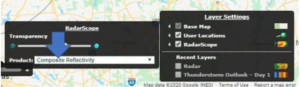
Enabling RadarScope
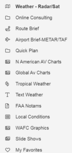
- Start by opening the AviationSentry Weather – Radar/Sat and locate the layers tab.
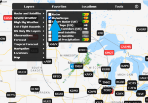
- Under Layers, at the top of the screen, select the Radar and Satellite category.
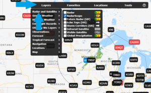
- Enable the RadarScope layer.
How to Use RadarScope
- RadarScope provides the raw data from the operational NEXRAD radar array in the United States, Australia and a few additional countries.
- You can only view one radar’s data at a time. To change radars, click on the name of the radar that you would like to view and to change the data hover over the RadarScope layer in the legend at the bottom and choose the desired data layer.
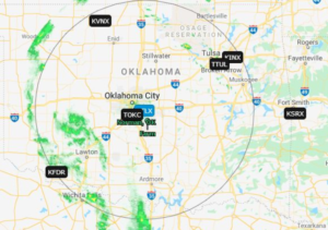
- You can change the tilt of the radar bean to view the data at higher or lower elevation.
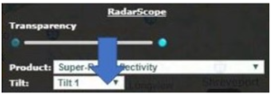
- The most common layers are listed below. Click on them to learn more about the specific product.
- To better understand and learn more about all the available layers visit the RadarScope academy here.
Tips
- You can stack additional layers on top of the RadarScope layer to view the most detailed and relevant information. Note: You cannot add the composite radar layer on top of the RadarScope layer.
- The data can be animated like many other layers on the map, click here to learn more basic settings about the map.
- To learn more about downloading RadarScope on your smart device or computer contact your Customer Success Manager.